October 30, 2020
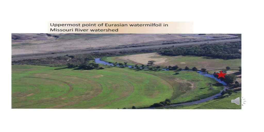
The Jefferson Slough is the highest point of Eurasian Watermilfoil infestation in the Upper Missouri River Watershed. Heavy Eurasian Watermilfoil exists in 4.6 miles of the Jefferson Slough. Once established, this rapidly spreading freshwater weed out competes most native plants and interferes with recreational activities, wildlife habitat, and facilities having water uptake systems.
It has been estimated that prior to the ongoing Eurasian Watermilfoil projects underway in the Jefferson Slough that annually 17,000 lbs. of Eurasian Watermilfoil fragments were contributed to the Jefferson River. These fragments then created Eurasian Watermilfoil infestations in other areas in the upper Missouri River.
The following are projects completed to date that are designed to control Eurasian Watermilfoil in the Jefferson Slough. More detailed explanation for the projects can be obtained from the JRWC jeffersonriverwc.com.
Jefferson Slough Flow Study
The Jefferson Slough flow study was funded by the Montana State legislature in 2013. The study was used to create a Jefferson Slough Management Plan for the control of Eurasian Watermilfoil.
Genetic Analysis and Establishment of Eurasian Watermilfoil Monitoring
Genetic analysis was conducted on 26 milfoil samples collected in 2014 from permanent sampling points in Jefferson Slough. The purpose of the collection and analysis was to determine if there were different biotypes/hybrids present in the system and gather pre-treatment baseline distribution and abundance data on milfoil biotypes This information was important as hybrid milfoil may respond differently to management actions
Environmental Assessment & Herbicide Applications 2016, 2017, 2018, 2019 & 2020
In 2015 an environmental assessment was completed for the first herbicide application in 2016.The following years five (5) herbicide applications have been completed. Utilizing the same one hundred permanent sampling points established in 2014 the County and its contractor resurveyed the Jefferson Slough from the uppermost point of the Eurasian Watermilfoil infestation downstream to the confluence with the Boulder River. The sampling revealed a different reduction level in Eurasian Watermilfoil dependent on the location in the slough. The full report can be obtained on the JRWC web site.
Flow Management Plan
Jefferson County assisted the Jefferson Slough Water Users Association to reinstall stream gauges used in the development of the Hydrologic study to allow the water users to develop flow management plan.
Casagranda Bypass Flushing Project
The first sediment reduction project was installed in December 2014. The project involved the flushing of sediments behind the Davis Dam into a gravel pit on the Casagranda property.
Phase one Jefferson Slough Channel Relocation
Construction of the phase one steam relocation project was completed in October 2018. A total of 3,600 feet of channel were relocated. The old channel which contained the Eurasian Watermilfoil was filled using the materials from the new channel and materials from borrow areas near the slough.

Pre-construction

Post Construction
Phase 2 Stream Channel Relocation
Using funds appropriated in the 2019 Montana State legislature the second phase channel restoration located on the Tim Mulligan ranch is now in the planning phase an estimated additional 1,700 linear feet of channel restoration is scheduled to be completed in 2021. Once phase 2 is completed approximately one mile of the Jefferson Slough has been treated with a remaining 3 miles left to treat as well as two major diversions located on the slough.