It’s All About Water
Commonality
The Jefferson River Watershed Council (JRWC) grew out of concern by local irrigators of solving ongoing water shortage problems in upper Jefferson River area and the strong interest among anglers about a decline in fish populations. Realizing that they shared a common interest in the health and vitality of the upper Jefferson River, a small but diverse group of basin residents met in the spring of 1999 to begin a series of informal discussions about natural resource issues affecting the watershed. The group has quickly evolved into a very dynamic local watershed group. By developing a Drought Management Plan and serving as a forum for communication, JRWC played the key role during the drought of 2000, helping both irrigators and the fishery survive the crisis.
Jefferson River Watershed Council is made up of representatives from local agriculture, conservation, business, recreation, and community interests, as well as representatives from local municipalities and advisors from government agencies and nonprofit organizations. The group seeks to be a positive voice for the effective management and enhancement of the basin’s resources. Jefferson River Watershed Council operates on a cooperative and consensus basis.
Mission Statement
“The Jefferson River Watershed Council is a forum to promote locally based resource management in the Jefferson River watershed. Through a spirit of cooperation and sharing, our mission is to coordinate efforts that will enhance, conserve, and protect the natural resources, the quality of life and the economic vitality of the area.”
River Information
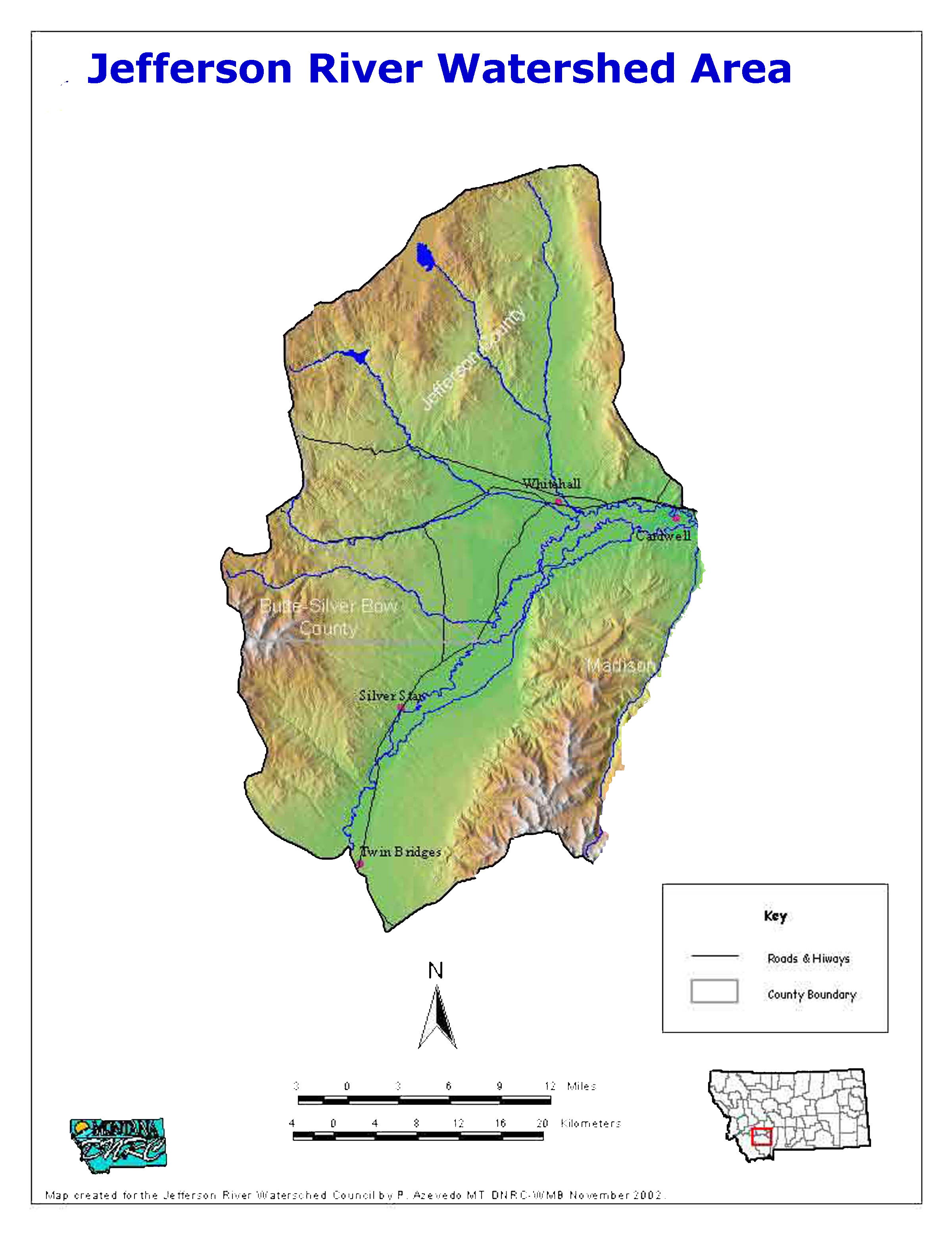
Jefferson River is formed by the convergence of the Ruby, Beaverhead and Big Hole Rivers, near present-day Twin Bridges; and flows for nearly 80 miles before combining with the Madison and Gallatin Rivers at the headwaters of the Missouri River.
The upper Jefferson River watershed area encompasses approximately 734 square miles of land in Jefferson and Madison counties beginning at the Jefferson River’s point of origin near Twin Bridges and extending to its confluence with the Boulder River near Whitehall. The watershed area includes a number of tributary streams which drain into portions of the Tobacco Root Mountains to the south, and the Highland Mountains to the north.
Board of Directors
The Jefferson River Watershed Council (JRWC) was created in 1999. The JRWC is a Montana based 501(c)3 nonprofit organization. JRWC includes all interests that may be affected by water-use and natural resource management within the watershed. The council seeks to develop practical solutions to difficult problems which impact the upper Jefferson River.
Thus, local landowners, irrigators, ranchers, outfitters, businesses, sporting/recreation, nonprofit organizations and government agencies have contributed to the creation of the Jefferson River Watershed Council and its continued success.
The organizational structure includes a Board of Directors, which acts as an overall watershed council made up of the above organizations and business sectors, as well as various committees on an as needed basis.
Board Members
Tom Harrington-Board Chair
Chuck Buus-Vice Chair
Chris Edgington-Drought Plan Coordinator
Don Hagerty-Board Member
John Patritti-Board Member
Mary Sutherland-Board Member
Ellie Ross-Secretary